The Tour du Mont Blanc or TMB is one of the most popular long-distance walks in Europe. It circles the Mont Blanc Massif covering a distance of roughly 170 kilometres (110 mi) with 10 kilometres (6.2 mi) of ascent/descent and passes through parts of Switzerland, Italy, and France.
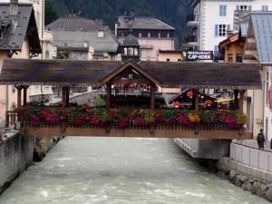
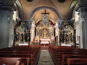
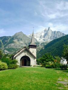
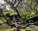
Upon arriving in Geneva, I met my room-mate Sydney. I had hiked with her parents in Peru. They were supposed to be coming on this trip also but had to cancel last minute due to health issues. I also met my guide Wam. We then rode to Chamonix. We had time that afternoon to settle in, relax, and explore delightful Chamonix, a world-famous resort town nestled at the foot of Mont Blanc and the site of the first Winter Olympics held in 1924. That night we shared a welcome dinner and got acquainted with our traveling companions and guide. A few pictures from walking around Chamonix…
-
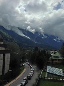
- The view from my hotel balcony
-

- Cheese! 🙂

-
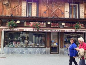
- This was a little shop that sold local specialties- cheese, sausage, mushrooms, etc.

-

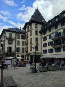
- A cute little restaurant.
-
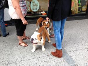
- French English bulldogs
-

- Sausages

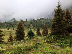
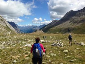
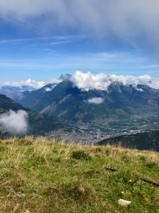
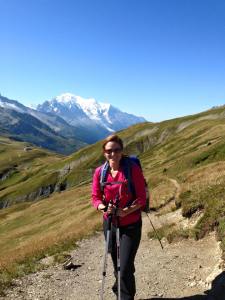
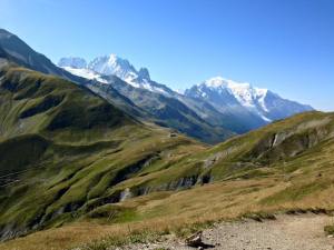
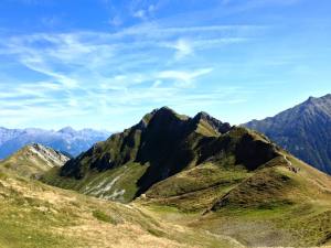
On the next day we began our spectacular journey on a trail beneath the Aiguilles Rouges (Red Peaks), a crystalline mountain massif opposite the Mont Blanc range. We hiked to La Flegere where we came to an amazing high path known as the Grand Balcon. Along this trail we enjoyed magnificent views of the rocky spires and glaciers draping the Mont Blanc massif across the valley before descending back to Chamonix. Today’s hike was 7 miles with 2,770 feet elevation gain and loss.


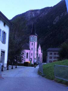
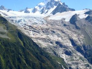
The next day began with a cable car ascent from Les Houches to Bellevue where we started our hike beneath the tumbling Bionnassay Glacier to the Col du Tricot. The weather was crappy for the first part of the day, very wet, but got better as the day went on. Along the way we watched for bounding chamois, a goat-like antelope, on the hillsides. After a steep descent to Chalets de Miage we stopped for lunch amongst picturesque alpine meadows. From here we continued up to Chalet du Truc and then on to Les Contamines, a charming town proud of its gastronomical heritage. We stayed in a local auberge that night. Today’s hike was 8 miles with 2,367 feet elevation gain and 3,127 feet elevation loss.


The next morning we followed in the footsteps of the ancients as we hiked on an old Roman road, making our way steadily uphill and passing a very early chapel with Renaissance frescoes on its interior. We were reminded of why this area is such a magnet for hikers and climbers as we followed varied terrain through forests, gentle glens, and the treeless gorge of the Nant Borrant on our way to Col du Bonhomme, our lunch spot. In the afternoon we descended a relatively steep grassy trail leading to the remote hamlet of Les Chapieux. We overnighted in an auberge there. Today’s hike was 11 miles with 4,318 feet elevation gain and 3,048 feet elevation loss.

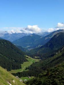


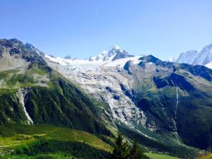
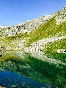
Our path the next day led us out of France and into Italy- from “Bonjour” to “Buongiorno”. We initially transferred from Les Chapieux to the trailhead at the Vallee des Glaciers, climbed east over the Col de la Seigne, and finally descended into Italy to the reflective Lac Combal. The weather cooperated and the views along our route took my breath away. The dramatic southern face of the Mont Blanc range was fully exposed above us as we hiked down to La Visaille from where we transferred to the lovely Italian resort town of Courmayeur. On the way down, I saw a man day hiking in a Speedo. We had time to enjoy the town and Sydney and I had dinner on our own. Today’s hike was 8 miles with 2,400 feet elevation gain and 2,740 feet elevation loss.
-

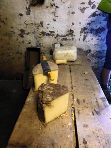
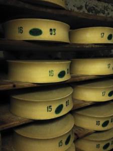
- en route we visited a little farm where they made beaufort cheese
-

- one hand in france and one in italy

-

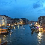
- the town of courmayeur

-

- gelato!
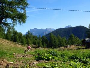
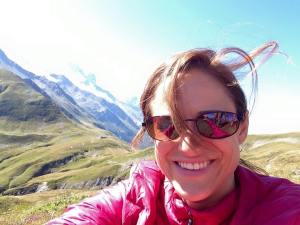
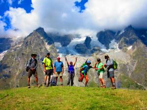
Our guide Wam promised that the next day would be a highlight of the TMB, and it was! We started hiking right from our hotel and on to La Montagne de la Saxe. The weather was perfect today. I could smell the wild oregano growing and it was wonderful. The ascent rewarded us with magnificent views of the Grandes Jorasses, Brenva Glacier, and the Italian side of Mont Blanc soaring into the air. A balcony trail led us to the Rifugio Bonatti, named after the famous Italian alpinist and adventurer Walter Bonatti. This is one of the best-kept huts in the Alps, and the walls inside are decorated with pictures showcasing Walter Bonatti’s impressive life story. The dramatic scenery was best appreciated while enjoying a drink in the sunset light. It was like an international happy hour- hikers from all over the world having beers together and looking at the beautiful mountains. Today’s hike was 8 miles with 3,000 feet elevation gain and 600 feet elevation loss.


-

- Mont Blanc
-
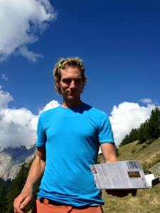
- Wam the guide always carries chocolate 🙂
-

- Stopped here for a limonata
-
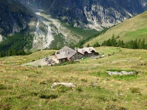
- Rifugio Bonatti
-

- Hiker happy hour
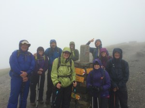
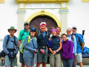
The weather was very cold and wet the next day. For most of the day I saw nothing but fog. We crossed from Italy into Switzerland at the Grand Col Ferret. We were good sports and stopped for the obligatory group photo at the border. Our muddy path ultimately led us to our evening’s auberge in the quiet but scenic village of La Fouly. For dinner, we got to try Raclette- the specialty dish of the region. Raclette is a type of cheese that they melt and scrape onto the plate, then you eat it with baked potatoes and pickles. Today’s hike was 10 miles with 2,520 feet elevation gain and 3,830 feet elevation loss.
-
- This is the Grand Col Ferret, Italy/ Swiss border. I took the photo the afternoon before because we knew bad weather was coming the next day
-
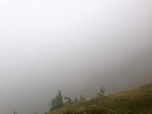
- My view all day
-
- Italy/ Switzerland border
The next day was one for soaking up the pure pleasures of being in the truly great outdoors as we proceeded at a leisurely pace, trekking through forests, fields of wildflowers, and quaint Swiss villages. In the last Swiss village, we had a lovely surprise lunch spread waiting for us. The combination of wine and espresso caused me to have a giggling fit when I overheard a man outside say, “Hand me my skirt.” If you know me, you are familiar with my giggling fits. 🙂 After lunch our hiking got steeper as we climbed through woodlands to the lovely alpine town of Champex, offering a perfect resting spot for the night- a small resort beside a pretty blue lake with several restaurants and bars around. Today’s hike was 9 miles with 1,378 feet elevation gain and 1,854 feet elevation loss.
-

- Note that the water never comes down the hill
-

- Perfectly stacked firewood. Everything in this village was so neat and orderly. I would not fit in here. 🙂
-

- Gnome display
-
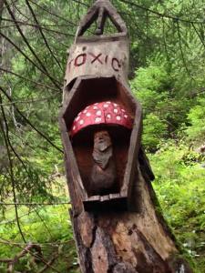
- A warning not to eat the poisonous mushrooms in the forest. The toxic ones grow in the same forest as the coveted Chanterelle mushrooms.

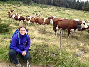
The next day we continued to enjoy this picturesque area beginning with an hour and a half of easy hiking along the “Bovine Route” that herders once used to guide their stock across the mountains. All day long we could hear the sound of cowbells tinkling in the breeze as we walked. Continuing across the rolling terrain, we enjoyed views of the rocky Dents du Midi and ascended through the forest to lookouts high over the lovely Rhone valley and the town of Martigny. Views of the Bernese Alps were impressive before beginning an easy descent to the Col de Forclaz. Today’s hike was 9 miles with 2,434 feet elevation gain and 2,238 feet elevation loss.
-

- Swiss eggs
-
- These crosses are near every hut and farm
-

- Sleeping Saint Bernard
-

- Chocolate time again
-

- It makes you a little nervous walking by these big guys
-
- View of the town of Martigny
-

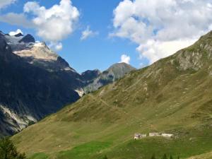
- View of the Bovine hut, where we stopped for lunch
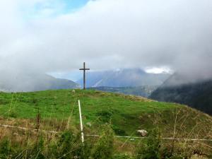
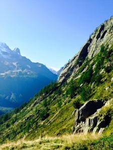
The next day our path followed an old smuggler’s route back into France. We hiked to Col de Balme, the border between Switzerland and France, and ate our picnic lunch while gazing down at the Swiss countryside behind us and the Chamonix valley ahead. The views of Mont Blanc were absolutely phenomenal. We descended to our hotel in Argentiere, just north of Chamonix. Today’s hike was 8.5 miles with 3,507 feet elevation gain and 3,225 feet elevation loss.
-
- The town of Trient


-

- Standing on the border of Switzerland and France

-

- View from balcony in Argentiere
On the next morning we took a short drive to the Col des Montets where we began our hike along the Grand Balcon to the spectacularly situated Lac des Cheserys with the many glaciers and peaks of the entire range in view. We finally closed the loop of our tour at La Flegere where our unforgettable journey began 10 days ago. The cable car at La Flegere carried us down into the valley over alpine pastures to Les Praz where we had a champagne celebration and toast and then returned to Chamonix. Today’s hike was 5 miles with 2,460 feet elevation gain and 1,103 feet elevation loss.


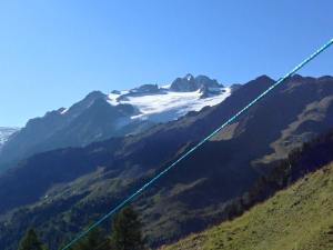
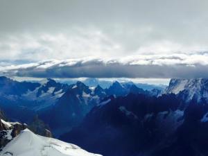
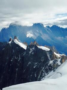
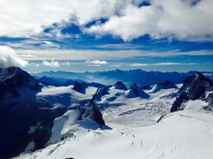
The next morning we took a historic 100 year old cog wheel train up to the Mer de Glace (Sea of Ice), one of the largest glaciers in the Alps. Early in the day Montenvers, the upper station, was still quiet and boasted an imposing panorama of the Mer de Glace, the Aiguille Drus, and the Grand Jorasses. A short ascent to Signal Forbes granted us even better vistas. From Montenvers, we traversed on the Northern Grand Balcon to the Plan de l’Aiguille, mid-station of the cable car to Aiguille du Midi. On this high path we had lovely views over the Chamonix valley and to the Aiguilles Rouges. We took the cable car up to the Aiguille du Midi which sits at 12,600 feet! From the top, there were spectacular views over the entire Mont Blanc range and of the Swiss, French, and Italian Alps. It was a pretty clear day so it was possible to see the Matterhorn, Monta Rosa, and the Grand Combin in Switzerland. It is another world up there. It is so quiet. All you hear is the whistling of the wind. After lunch the afternoon was free for us to explore on our own, which for me meant eating gelato and shopping for souvenirs. Today’s hike was 3 miles with 1,720 feet elevation gain.
-
- Views from Aiguille du Midi
-
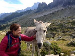
- “Wild” donkey. He was so sweet and fuzzy

-
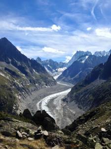
- Mer de Glace. View from Signal Forbes.
We gathered together again in the evening to watch the beginning of the Ultra TMB race. In this race, ultra runners come from all over the world. They run the trail we did over 10 days in about 20 hours! We had a farewell dinner in a Michelin restaurant in Chamonix, and raised a toast to an excellent adventure.
-

- Lining up for the start of the race
-
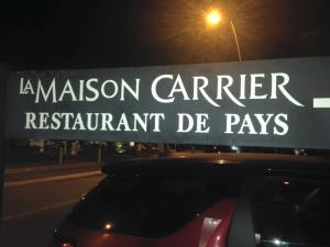
- The Michelin restaurant in Chamonix
-
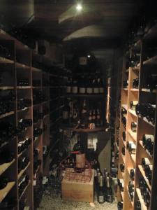
- Wine cellar at the restaurant
-
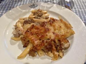
- My dinner was a mushroom pasta dish
This group of hikers made my summer. It felt so good to laugh, walk, and talk with them. It was yet another successful bucket list trek with REI Adventures.
-
- Photo taken by John Dawson
- Andy
//pagead2.googlesyndication.com/pagead/js/adsbygoogle.js
(adsbygoogle = window.adsbygoogle || []).push({});


Great trip. Sounds that you had an awesome time too. I did it last year too. So if you want to check out my blog about the TMB then your’re very welcome: http://www.worldtrip-blog.com/tour-du-mont-blanc/ I even wrote a free travel magazine about the TMB with a lot of photos and useful informations. Feel free to link to it if you want.
LikeLiked by 1 person